Looking for a place to go on a nice day off? After working all week, do you want to relax and relieve stress? Why not plan a trip to the outlying islands with family and friends? The editor has gathered two hidden island bays and integrated several routes that will definitely help you plan your trip!
Tung Lung Chau
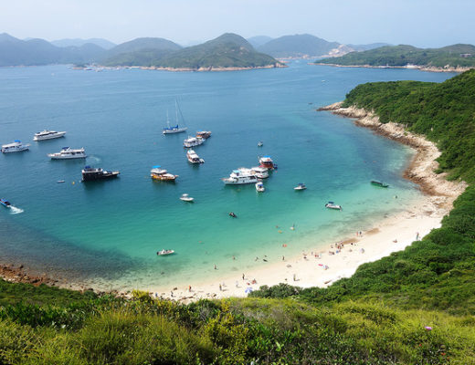
Tung Lung Chau is a small island below Victoria Harbour, about an hour’s boat ride away. With few visitors, it is a great place to escape and relax.
💡Route: Take the ferry from Victoria Harbour Pier → East Lung Chau (60 minutes) → disembark at Victoria Harbour Pier
If you don’t want to charter a boat, you can also take public transportation. However, it’s a bit more complicated as there are no buses or minibuses that go directly to East Lung Chau, so you need to transfer to a ferry to get there.
💡Route: Take the MTR to Yau Tong Station → Walk towards the industrial area for about 10 minutes → Transfer to the ferry at Sam Ka Tsuen Pier → Disembark at East Lung Chau Pier
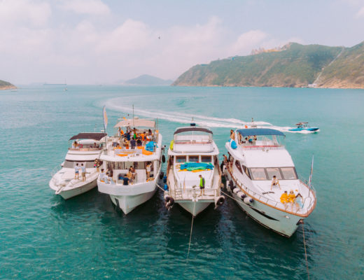
🔆YachtHolimood’s boats provide shuttle services and can take you directly from Victoria Harbour Pier to Tung Lung Chau, shortening your travel time. Details > Contact YachtHolimood for inquiries <
YachtHolimood also offers a historical and cultural tour of East Lung Chau to explore the island from a different angle! Click here for details
Step 1: Sightseeing + Hiking
💡Route 1: Simple version: Take the ferry from Victoria Harbour Pier → Disembark at East Lung Chau Pier (60 minutes) → Campsite (20 minutes) → East Lung Chau Fort (5 minutes) → Ancient Rock Carvings (20 minutes) → Viewing Platform (45 minutes) → East Lung Chau Rock Carvings (20 minutes) → Disembark at Victoria Harbour Pier
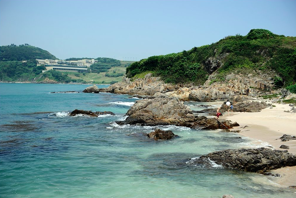
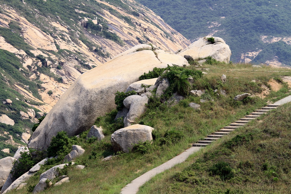
Walk up the small stone steps next to the pier and you will see a convenience store. Follow the signs to the left (most tourists choose to go left, as it’s a shorter route and suitable for families), and you will first see the Chicken’s Head Rock. After about a 20-minute walk, you will reach the campsite.
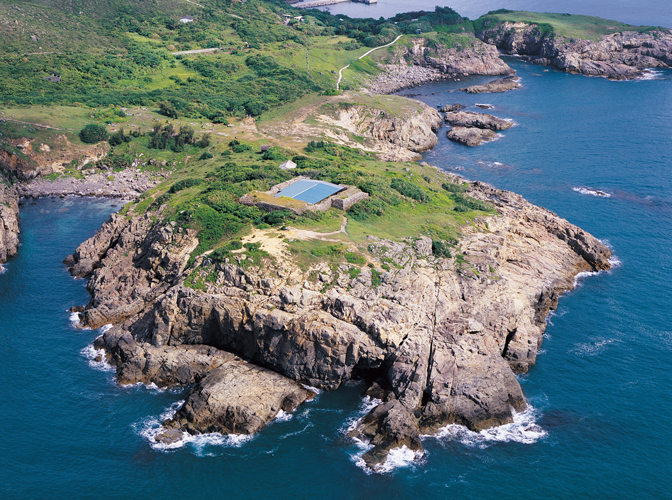
Continue for another 5 minutes to see the East Lung Chau Fort, a Hong Kong statutory monument.
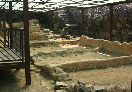
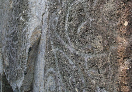
After circling around, you can choose to go right to see the ancient rock carvings before heading back to the pier.
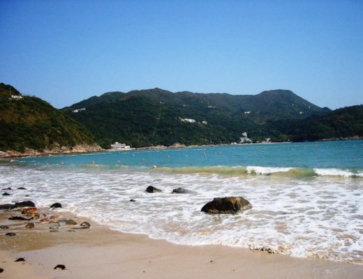
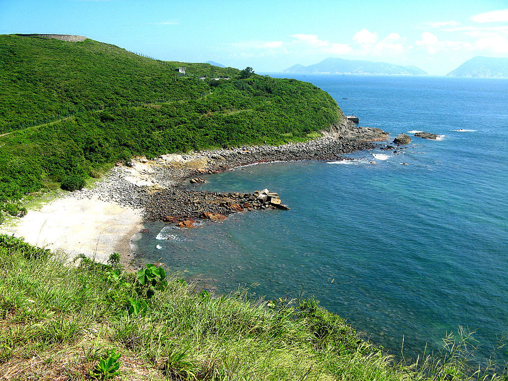
In addition to historical monuments, the natural scenery of East Lung Chau is also beautiful!
The water quality around East Lung Chau is very clear, and the sea views are breathtaking. It takes about 25 minutes from the pier to reach the viewing platform, where you can overlook the vast sea and see the panoramic view of East Lung Chau.
💡Route 2: Difficulty Version: Boarding at Victoria Harbour Terminal → Disembark at Tung Lung Island Pier (60 mins) → Ancient Rock Carvings (20 mins) → Deer Neck Bay (30 mins) → The Peak Launch Tower (20 mins) → Tung Lung Fort (40 mins) → Disembark at Victoria Harbour Terminal
Compared to other major islands, Tung Lung Island has fewer visitors, making it ideal for hikers who prefer less crowded areas.
Follow the small stone steps beside the pier and walk up. This time, follow the signs to the right (the mountain path is steep and difficult, so think twice before choosing it!), and go clockwise around the island.
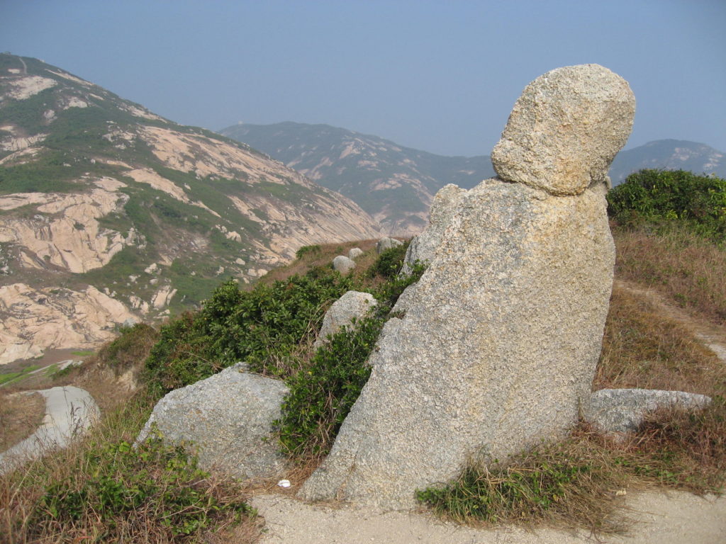
You can see the ancient rock carvings in just 20 minutes.
Continue walking along the mountain path and you will arrive at Deer Neck Bay in 30 minutes.
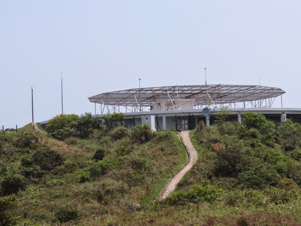
Walk up the mountain for 20 minutes and you will see the Peak Launch Tower.
Walk down the mountain along a small path for 40 minutes to the camping area to see Tung Lung Fort.
Finally, return to the pier.
Step 2. Picnic + Camping
💡Board at Victoria Harbour Terminal → Disembark at Tung Lung Island Pier (60 mins) → Sightseeing/Hiking → Camping Area → Disembark at Victoria Harbour Terminal
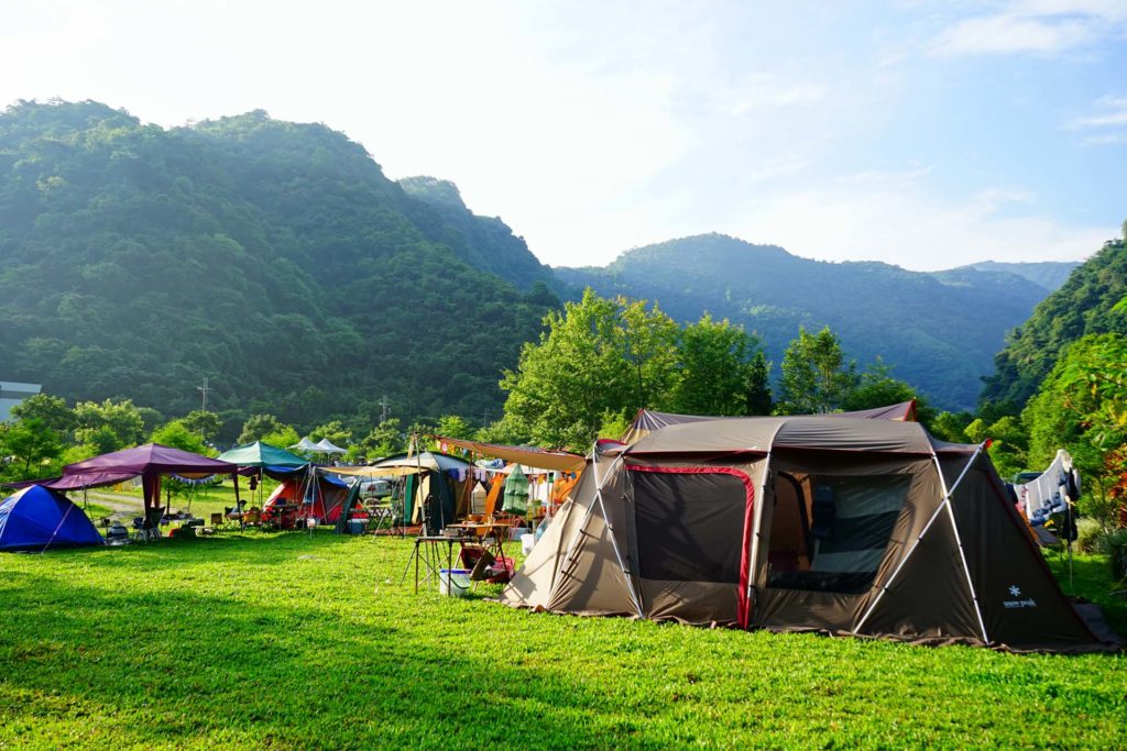
Want to go on a short two-day trip? Camping is definitely a good choice!
The camping area has a flat and spacious terrain, which is very suitable for setting up tents.
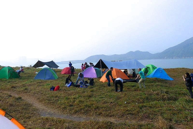
There are barbecue pits nearby where you can BBQ. You can also have a picnic on the grass, fly kites, face the expansive sea view, and enjoy the scenery in comfort.
Po Toi Island

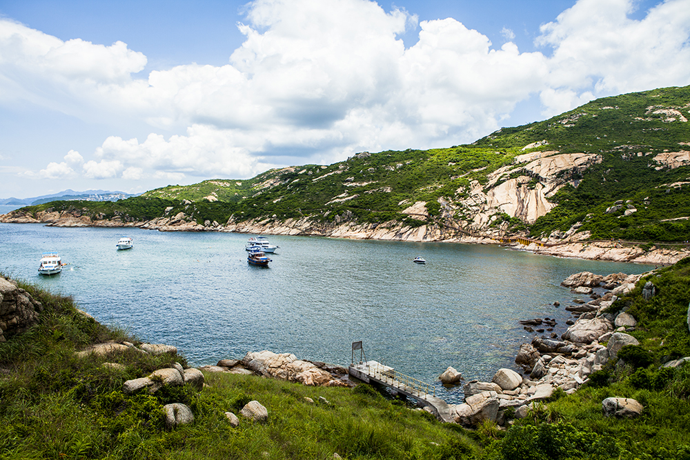
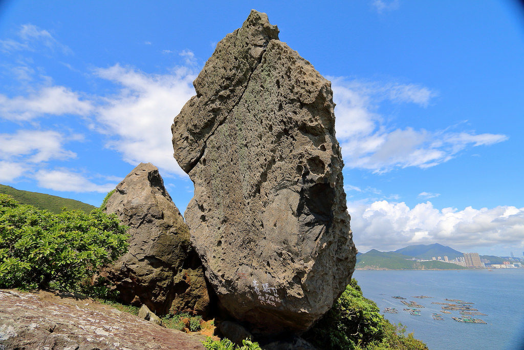
Po Toi Island is located at the southernmost point of Hong Kong, so it is called the “Antarctica of Hong Kong”. It is a small island full of strange rocks, and attracts many tourists every year to see these various shaped rocks. Many of them are considered the “10 most beautiful rocks in Hong Kong” by Hong Kong people!
💡Route: Board at Victoria Harbour Terminal → Po Toi Island (45 mins) → Disembark at Victoria Harbour Terminal
🔆YachtHolimood provides shuttle services on their boats, which can go directly from Victoria Harbour Terminal to Po Toi Island, shortening the travel time.
Step 1. Sightseeing + Hiking
💡Route: Board at Victoria Harbour Terminal → Po Toi Pier (45 mins) → Chicken Stone (10 mins) → Ngau Wu Teng Observation Pavilion (20 mins) → Monk’s Stone, Ling Turtle Stone (10 mins) → Cape D’Aguilar Lighthouse (10 mins) → Buddha’s Palm Rock (8 mins) → Po Toi Rock Carvings (15 mins) → Disembark at Victoria Harbour Terminal
After disembarking, go to the left and walk along the hiking trail beside the pier. Follow the signs to start climbing the mountain counterclockwise. You will first see Chicken Stone.
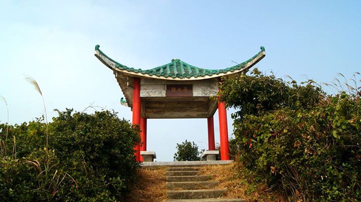
Continue walking for 20 minutes until you reach the highest point of the hiking trail – Ngau Wu Teng Observation Pavilion. You can see the panoramic view of Po Toi Island here.
Walk down the stone steps for 10 minutes and you will see the strange rocks – Monk’s Stone and Ling Turtle Stone.
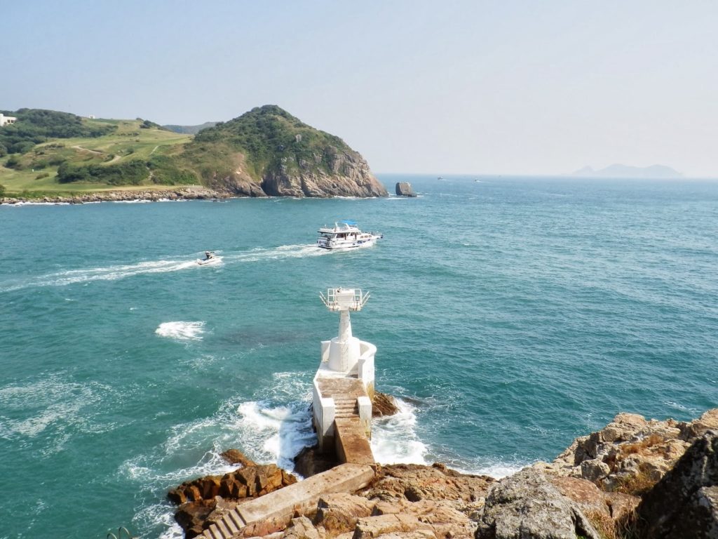
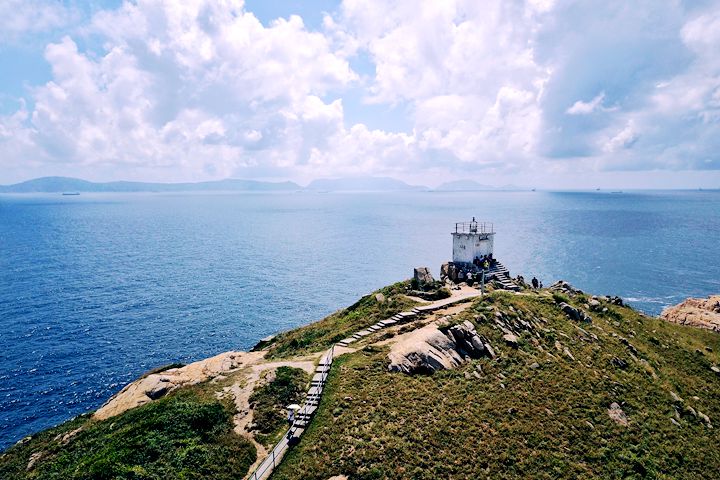
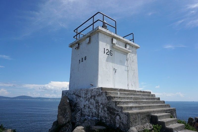
Follow the signs for 10 minutes to reach the popular photo spot – Cape D’Aguilar Lighthouse (126 Lighthouse). The white lighthouse against the blue sky and white clouds naturally becomes a popular photo spot for Hong Kong people.
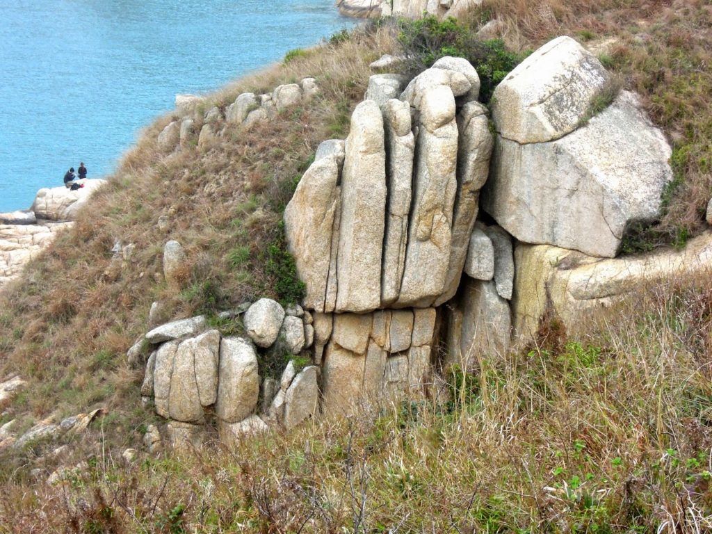
On the way back to the pier, you will see another strange rock – Buddha’s Palm Rock.
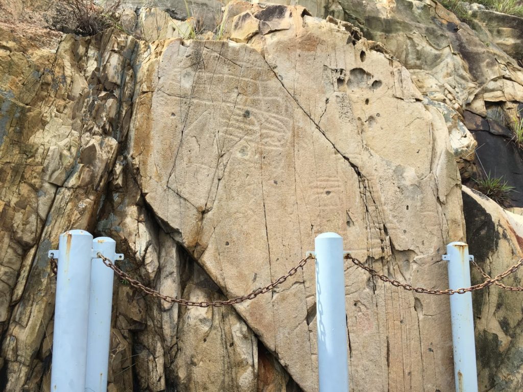
Continue walking along the stone steps towards the sea and you will see the Hong Kong statutory monument – Po Toi Rock Carvings in about 15 minutes.
Finally, follow the route back to the pier.
Step 2. Seafood
When you come to a place close to the sea like Po Toi Island, you must eat seafood!
💡Recommended route: Board at Central Pier → Po Toi Island Pier (45 mins) → Sightseeing/Hiking → Seafood → Disembark at Central Pier (45 mins)
🔆Restaurant recommendation: Ming Kee Seafood Restaurant is the only seafood restaurant on Po Toi Island. Many visitors come to it on weekends. The food quality is guaranteed!
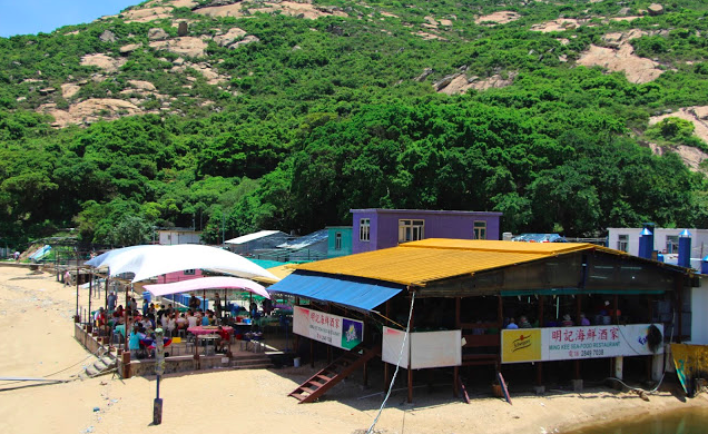
The seafood here is locally sourced and very fresh. Recommended dishes include seaweed soup and salt and pepper squid.
Step 3. Camping
💡Route: Board at Victoria Harbour Terminal → Po Toi Pier (45 mins) → Sightseeing/Hiking/Seafood → Camping near Cape D’Aguilar Lighthouse (40 mins from the pier) → Disembark at Victoria Harbour Terminal (45 mins)
Since there is no government campsite on Po Toi Island, most campers will find a flat grassland to camp. The ideal place is the grassland near Cape D’Aguilar Lighthouse (40 minutes from the pier). The grassland here is flat and easy to walk on, making it very suitable for camping.
(From the pier, walk along the hiking trail beside the pier, then follow the stone steps down for 10 minutes to see the strange rocks Monk’s Stone and Ling Turtle Stone. Then follow the signs for 10 minutes to reach Cape D’Aguilar Lighthouse.)
Other recommended places? 【Island Bay Article】3 Things Recommended by Hong Kong People on Lamma Island! Full Lamma Island Day Trip Guide
After reading this, are you already eager to explore the islands?
Rent a boat from>here< and set sail!